An Unforgettable Journey

DAY ONE

I began my journey with a shuttle bus from Takaka to the first hut at the beginning of the track, the Brown Hut. The bus arrived at 12pm and I got off the bus, grabbed my bag and headed off straight away.

Looking back at the shuttle after heading off

The first part of the track is a winding route that is on a gradual slope climbing up 915m, the track is mainly through the bush and is a pretty cool walk with great views of the valleys and hills in the distance.

Valleys in the distance

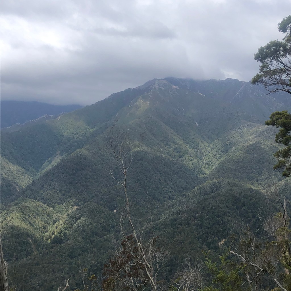
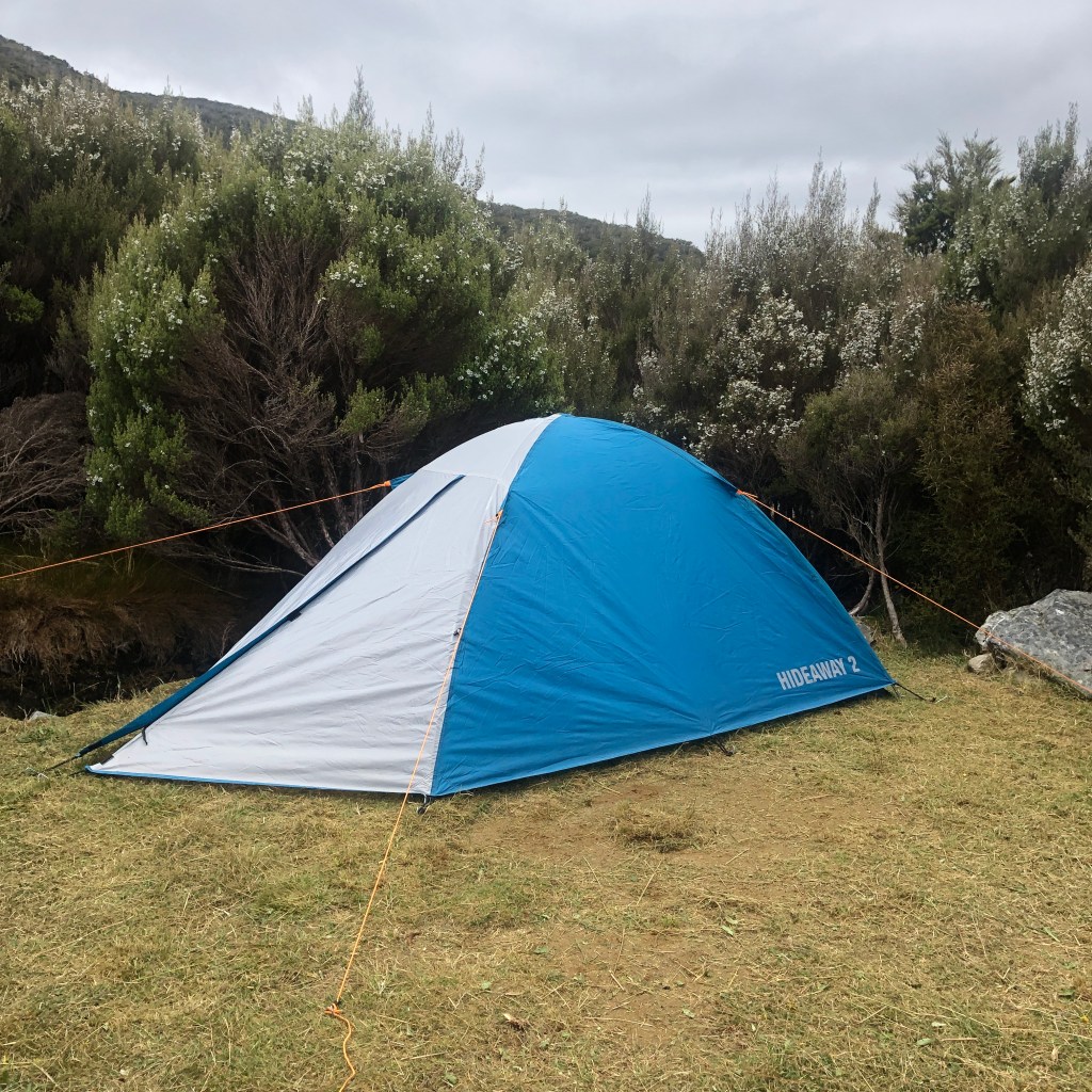
I walked around 3.5 hours up and then stopped at the Aorere Shelter, which is the first campsite you could stop at, however I had booked into the Perry Saddle, I chilled out and ate my lunch before heading off to my final destination for the day. On the way I stopped of at Flanagan’s Corner viewpoint to take in the views, supposedly you can see Mt Taranaki on clear days but unfortunately it was pretty overcast. I arrived at Perry Saddle Hut and set up my tent before taking a walk around.

Tent all set up

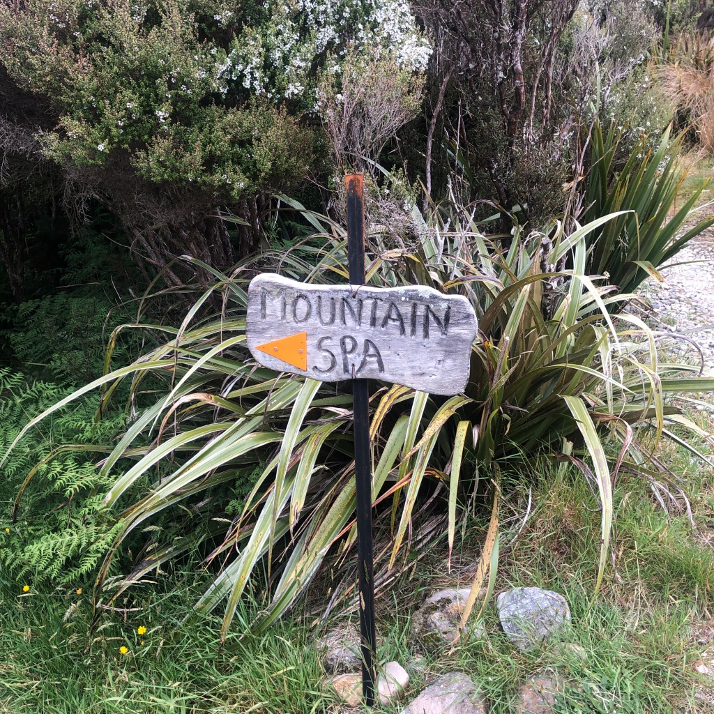
There was a small mountain spa further down the hill, which turned out to be just a small stream at the bottom of the hill but worth the 10-minute walk to get to it.

Walkway to mountain spa
Mountain Spa

I chilled out and relaxed that evening before cooking my tea of which I failed pretty badly at as I boiled way to much water for my sachet of soup that it was pretty much still water after it was added, but if anything it is a lesson learned. I then went back to my tent and went to sleep, getting ready for the biggest and longest day of the trek.

DAY TWO

Day two arrived, I awoke around 3am freezing cold so I chilled out and I had my breakfast and then a small nap after I had warmed up. I packed up my tent and set off at around 10am to get to the James Mackay hut later that day.

Valley stretches out

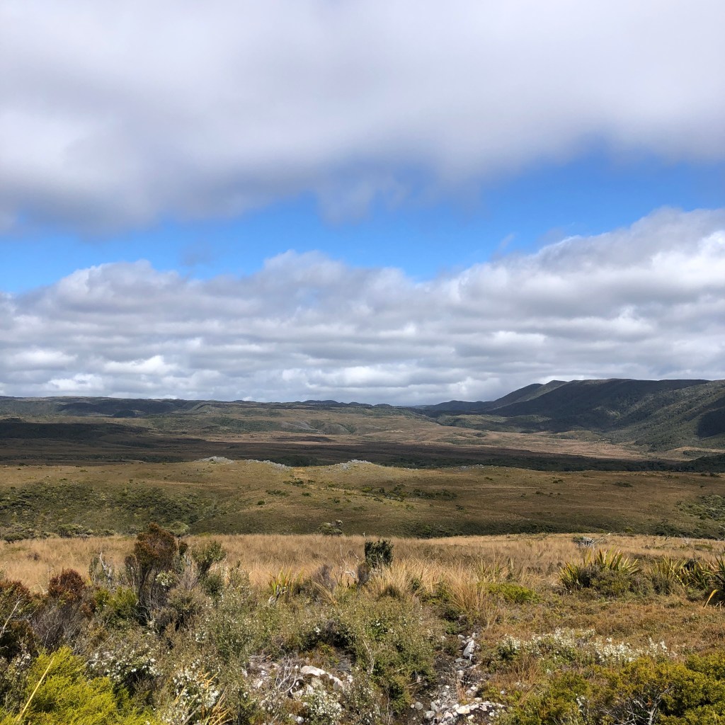
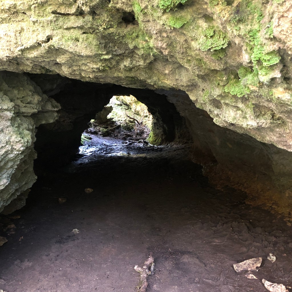
I walked for about 1.5 hours through fields of golden grass and marshland, the valley here begins to widen around the Gouland Downs and you can see for miles. After 1.5 hours I arrived at the first hut, took a short break and then headed back off down the track before coming to some caves to which I explored a little before continuing on my journey.

Start of the caves

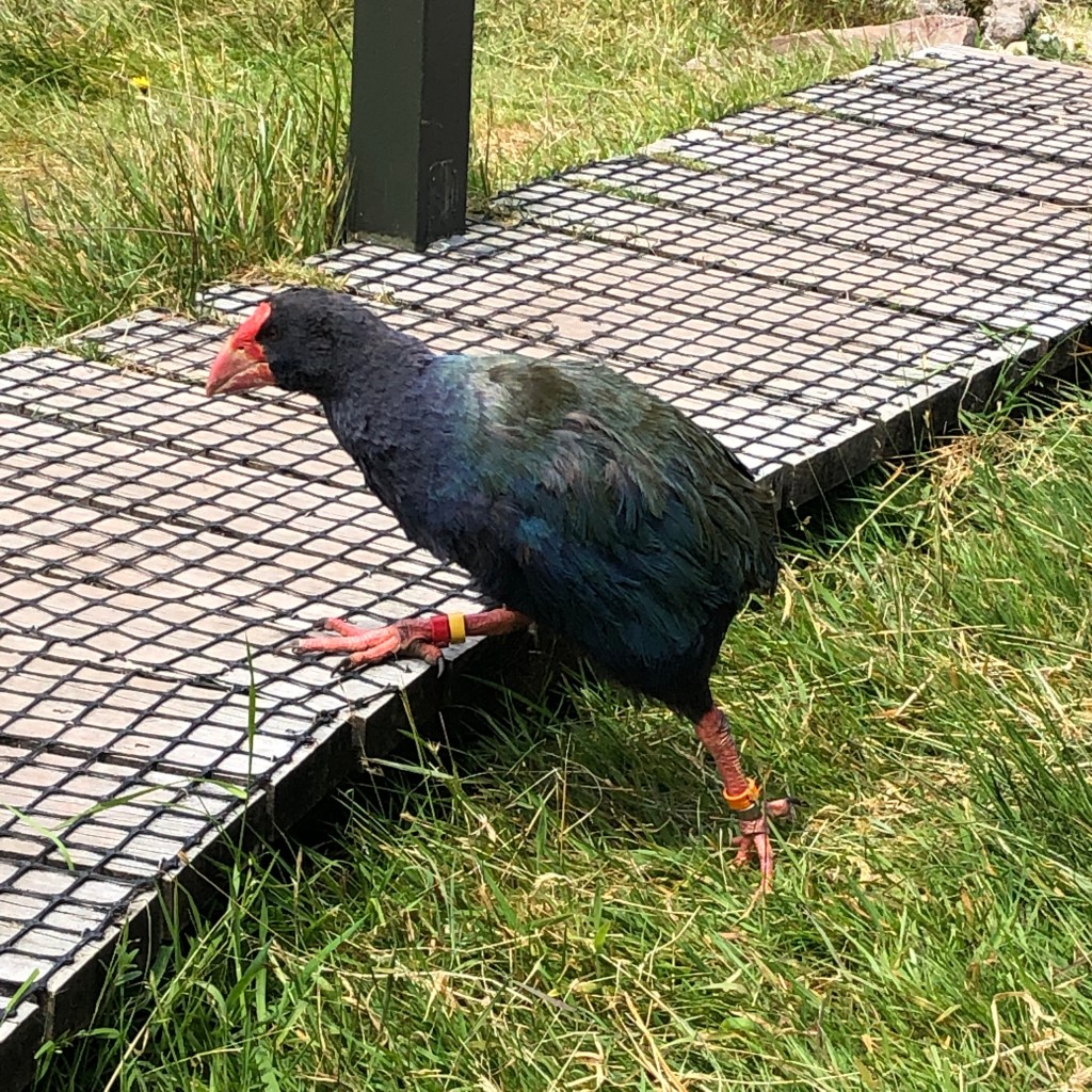
I got to Saxon Hut an hour later and ate lunch, whilst I ate I watched a Takahe (endangered bird) search for his dinner.

Takahe

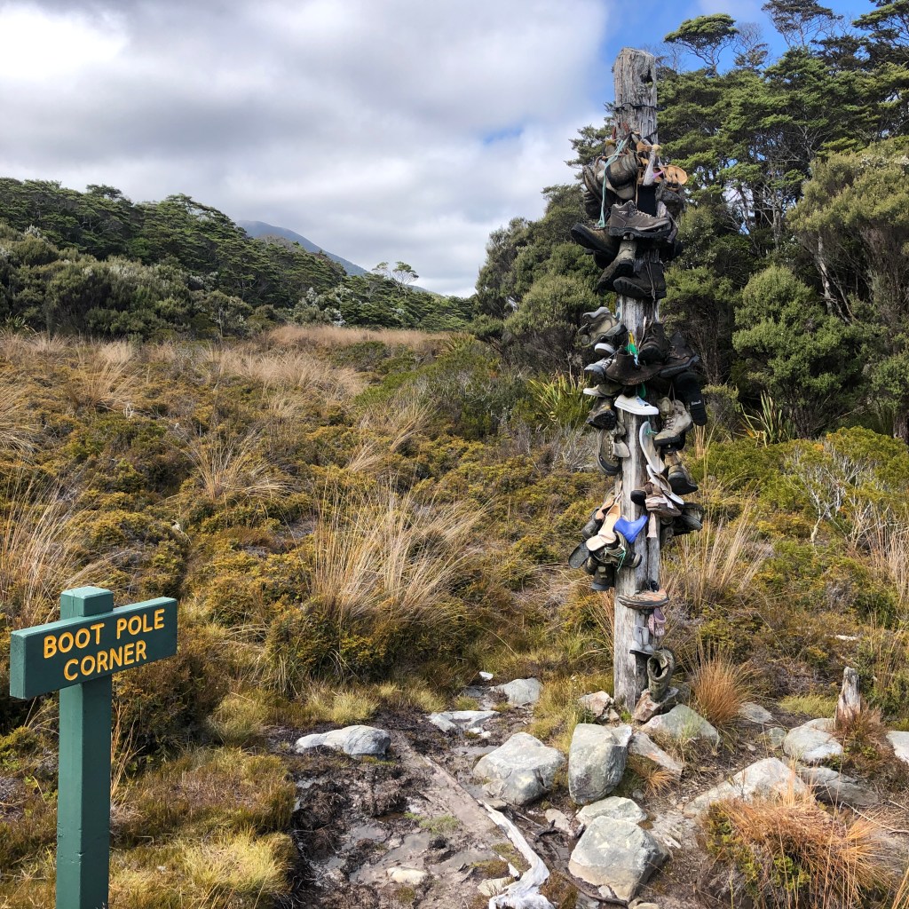
I finished up and continued on my way. There’s an old pole with old and new boots tied on or nailed to it along the way, which looked pretty awesome.

Boot pole corner

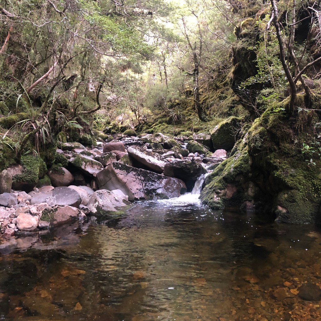
Todays hike was 24.2km and you could see pretty far across the hills in the distance and I crossed plenty of streams and brooks.

I arrived at today’s destination at about 4pm, set up my tent on the decking provided which took longer than I expected, as I had to use rocks instead of pegs.

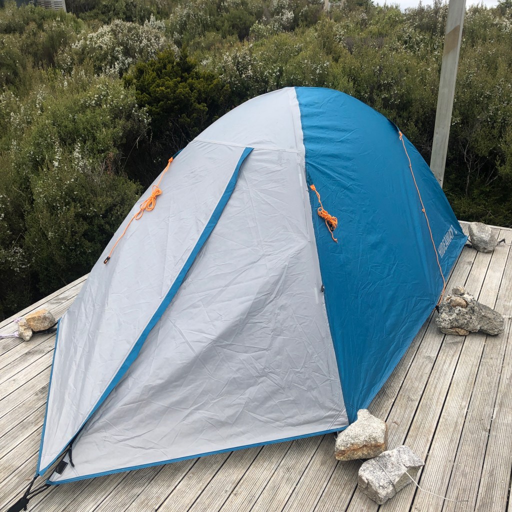
The area was pretty misty so there wasn’t much of a view. I cooked up my evening meal of mashed potato, peas and chicken with 3 Germans I had met on the track. We ate and then headed of to bed for the evening.

DAY THREE

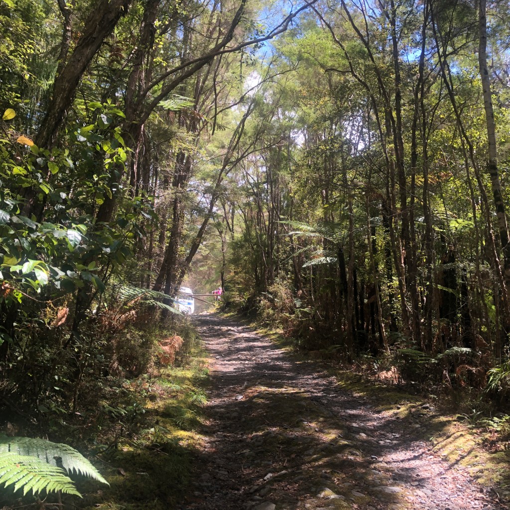
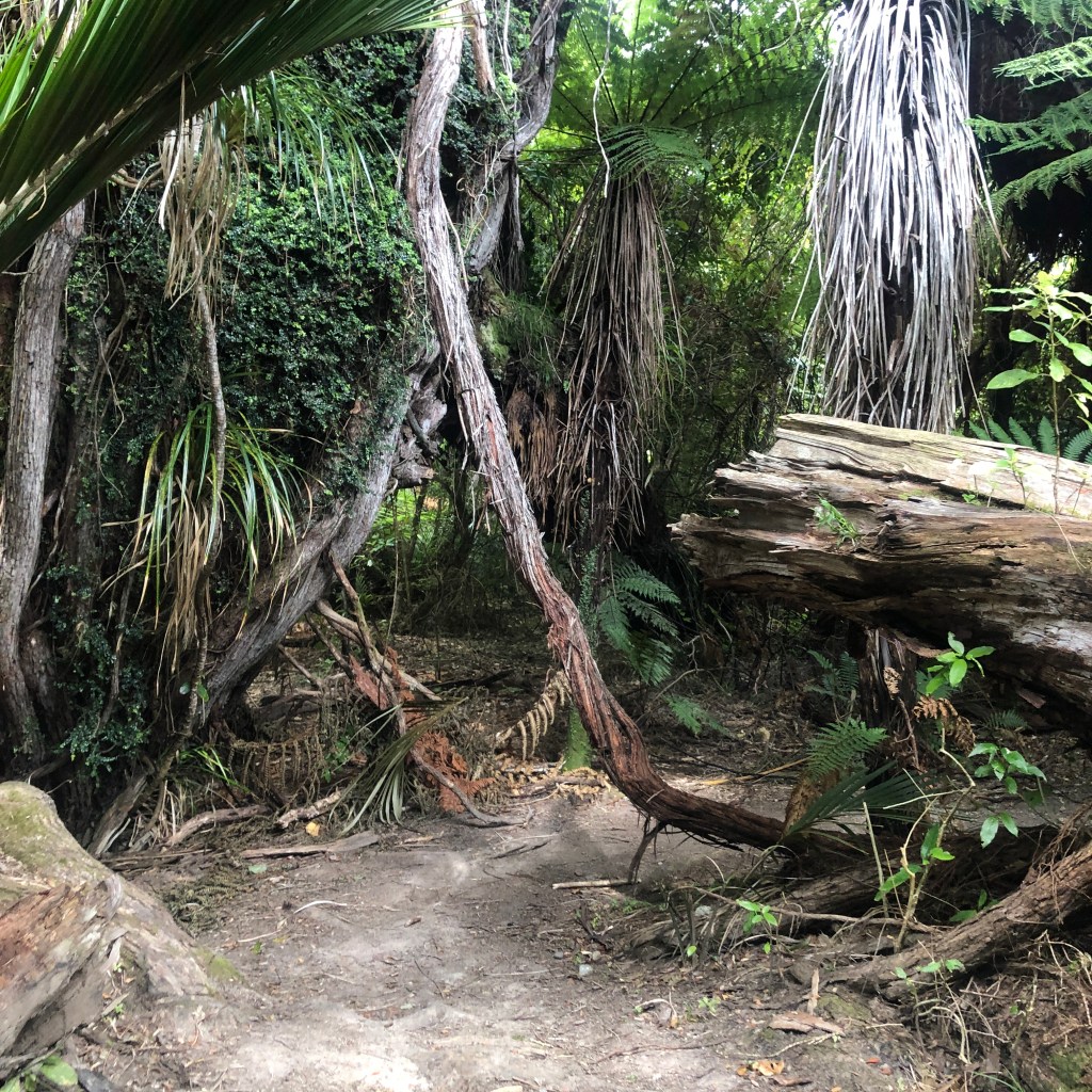
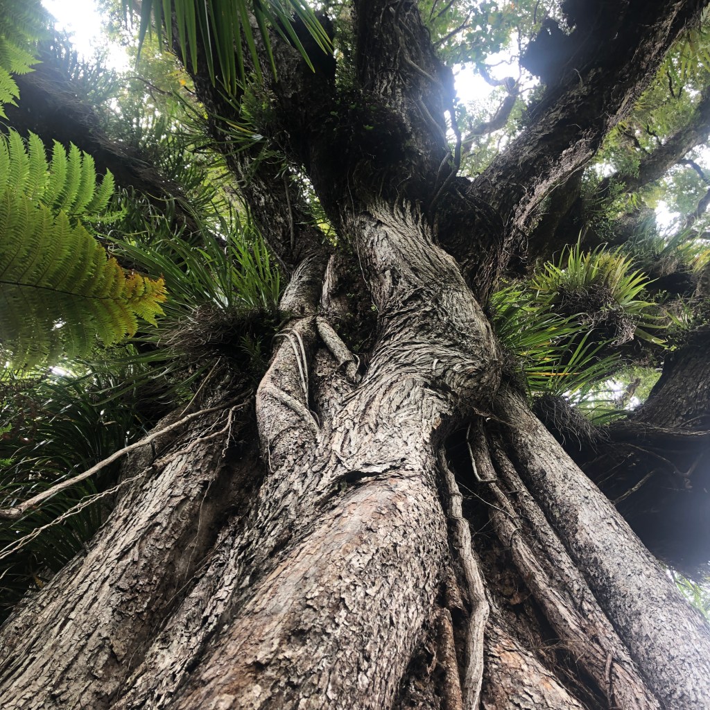
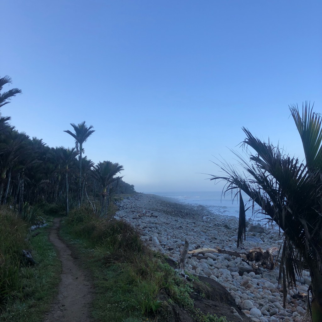
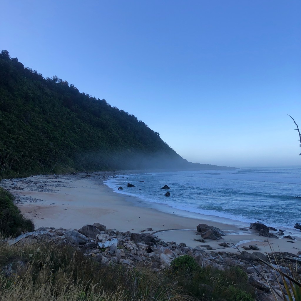
In the morning I awoke, it was still pretty misty but you could see the mouth of the river, which is where I was heading for the day, I ate and then packed up my tent once again and headed off around 08:45. This was my most favorite day, not because it was practically all downhill but that it was through what looked like an enchanted forest and where I first met the famous West Coast sandflies.

Drooping trees
Magnificent Trunks

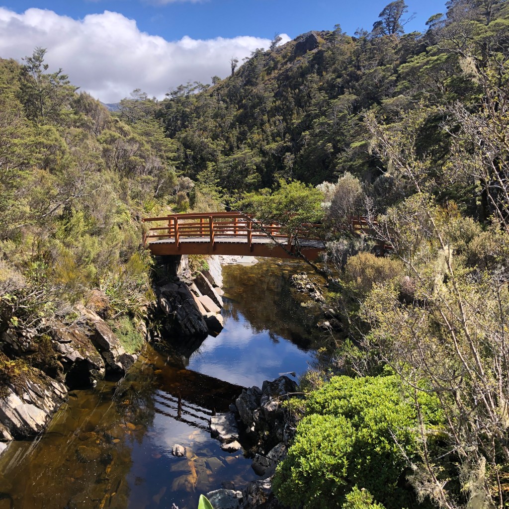
There were some swing bridges to cross, one of which was 148.8m long and the largest suspended deck bridge built by the Department of Conservation.

One of many swing bridges

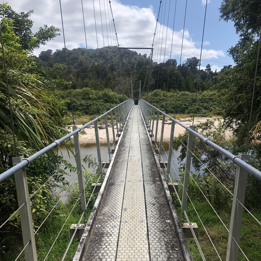
There are sections on this part of the track that after heavy rain can be pretty flooded especially at high tide but luckily the day turned out to be pretty clear and sunny.

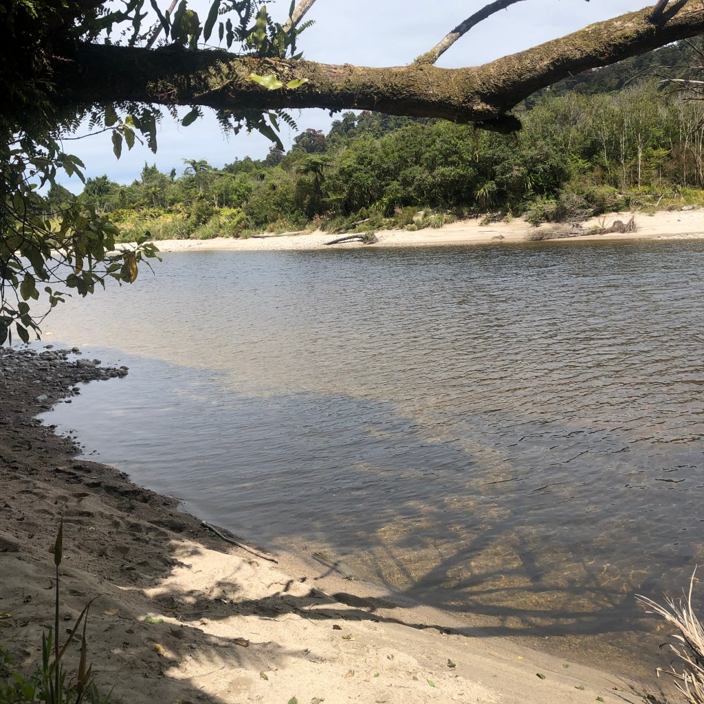
At this point you’re walking along the edge of the river and occasionally there would be a large clearing or small path down to a beach.

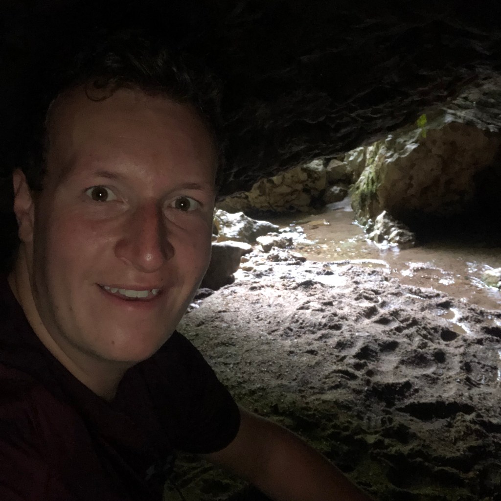
I was amazed at some of the trees in this forest as they are extremely large and magnificent. Further along I found a small cave which I went in as far as I could, unfortunately for me I later found out that the 3 Germans I met managed to get in further which just meant wading through a little water, but managed to see glowworms further into the cave.

Sitting in the cave entrance

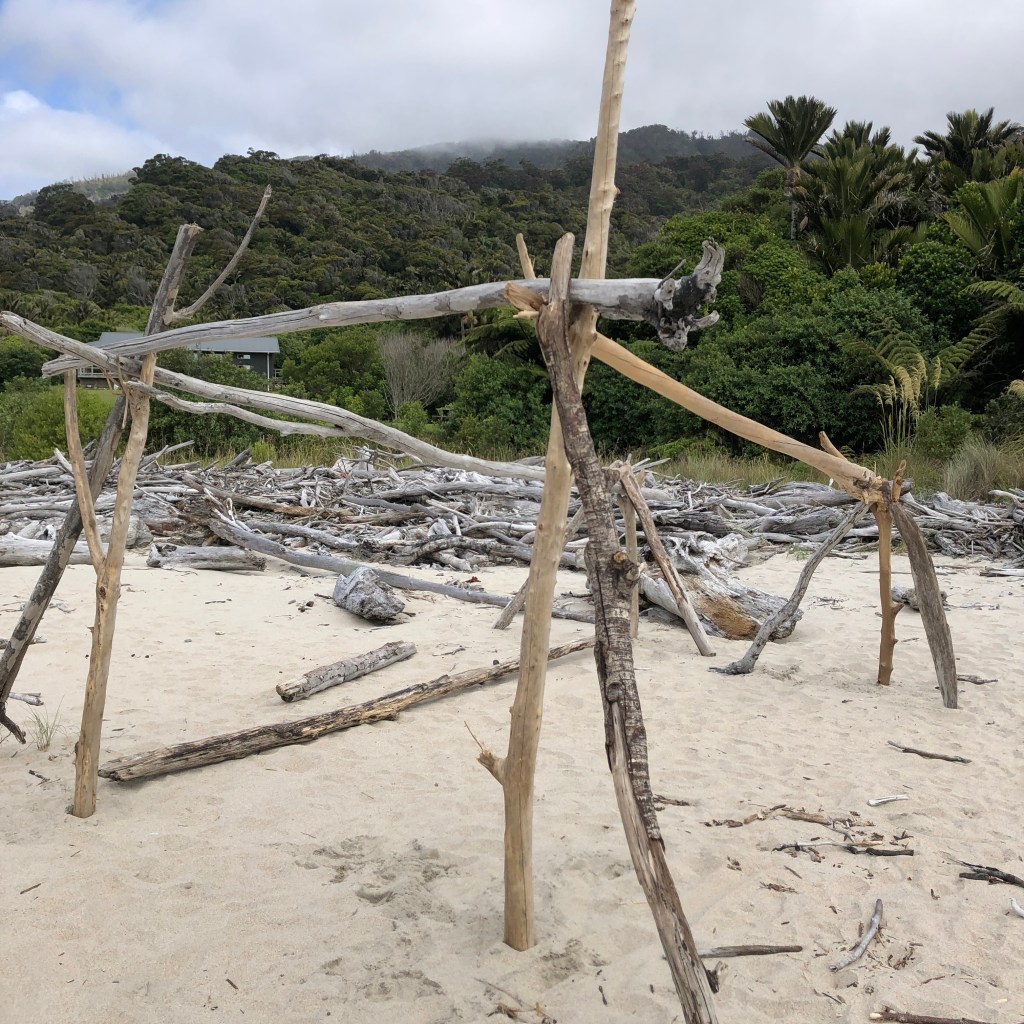
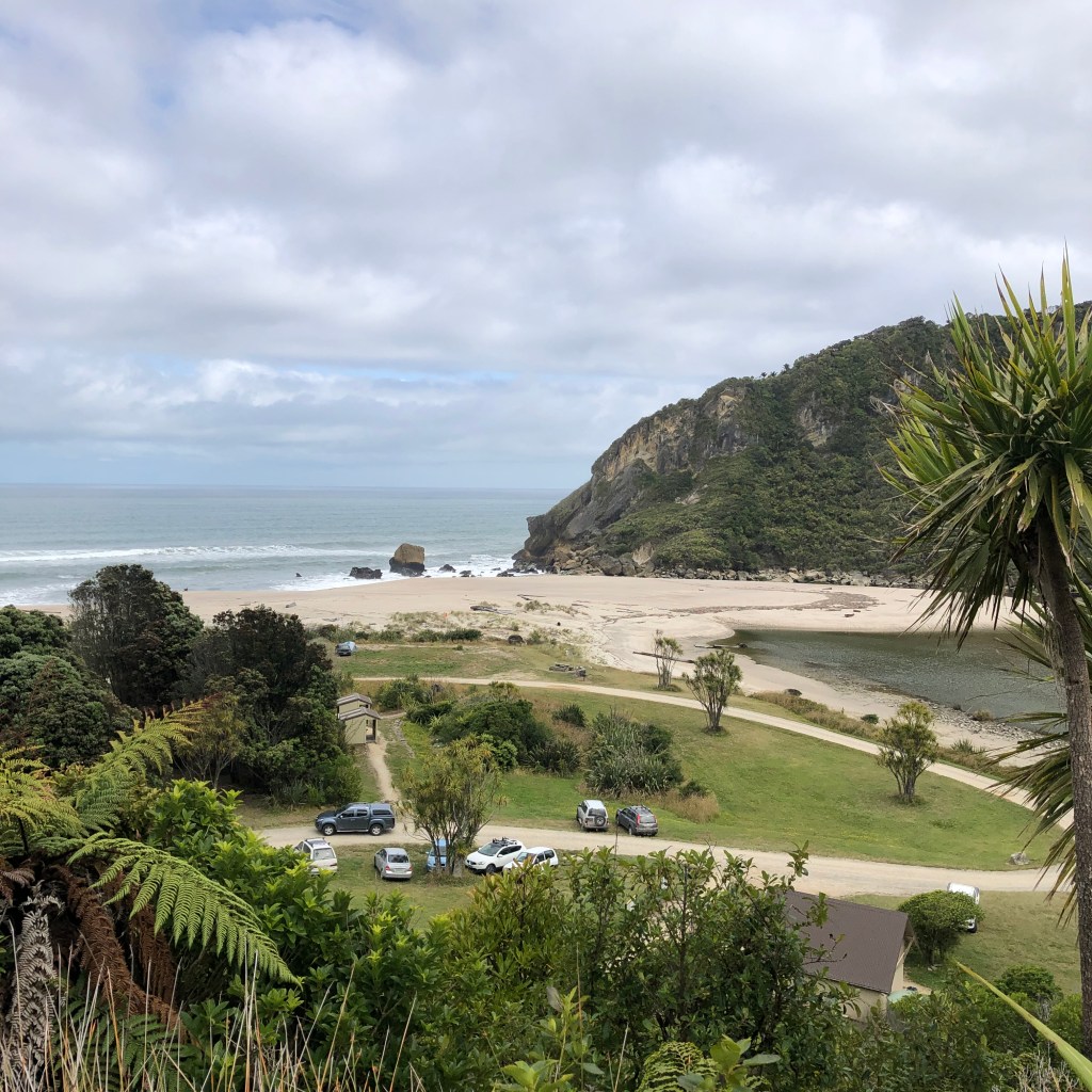
Anyhow I arrived at the final hut, the Heaphy Hut at around 13:30 and set up my tent to dry it, as it was pretty wet from the previous night. I saw a helicopter land at the hut and then take of which was cool to see and according to some people it’s not something you see everyday whilst hiking a great walk. I then ventured onto the beach and had a quick wash in the river, as it had been 2.5 days since I had last had a shower. I chilled out on the beach and attempted to create a large driftwood house, unfortunately when I added the roof it was two top heavy and collapsed, I had spent around 3 hours on this already and decided to pack it in as I was pretty exhausted and had been attacked my hundreds of sandflies.

The only photo I got before it collapsed

The 3 German guys arrived and they showed me a video of them swimming in the river and footage of one of the guys being bitten by an eel, which was pretty funny for me but the guy then couldn’t walk and carry his pack so his mate had to carry both of them.

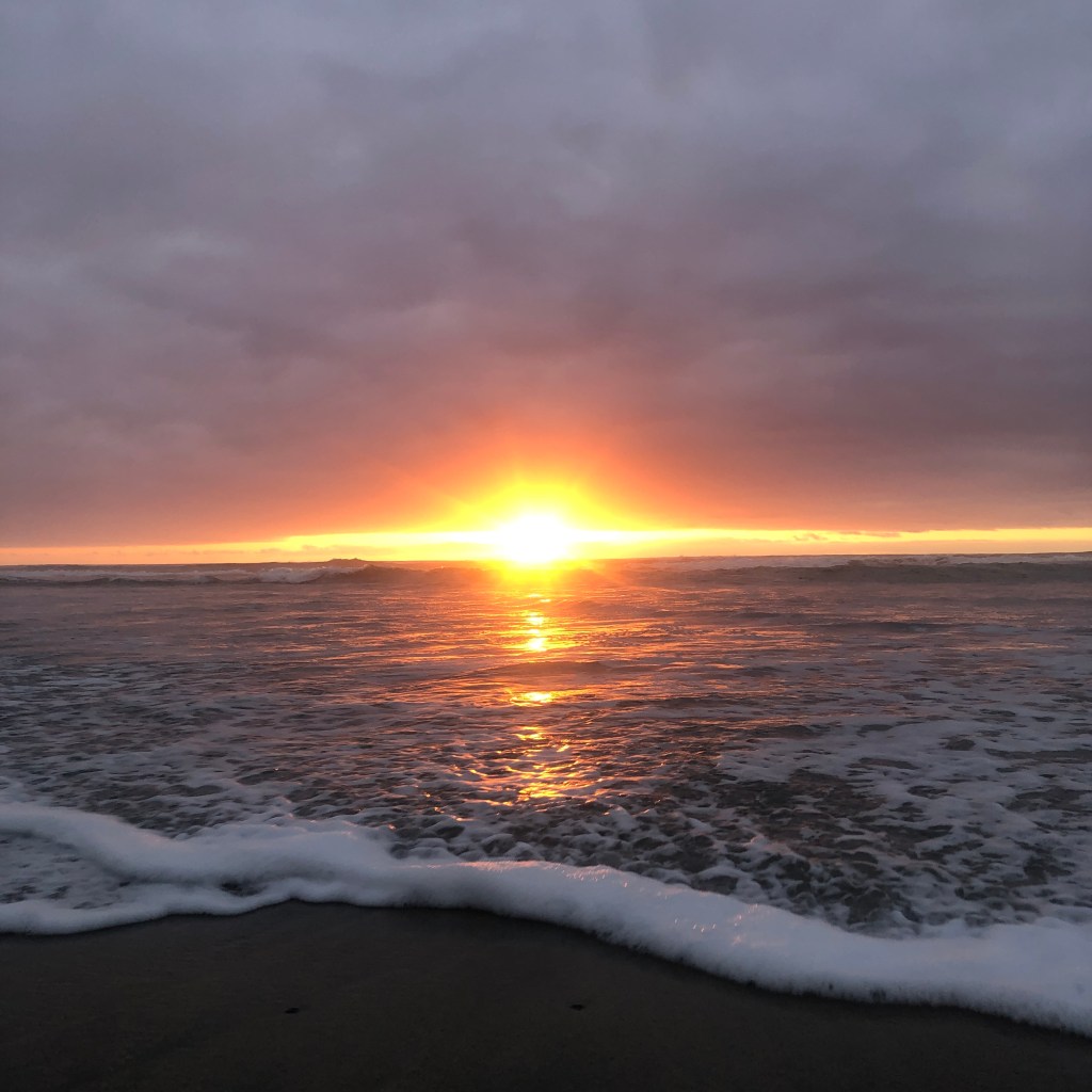
I cooked up my dinner and then went to watch the sunset at the far end of the beach, down the far end you could pick up the first signal I had seen the past 3 days so that was good.

Sunset on Heaphy Beach

DAY FOUR – FINAL PUSH

The next morning I woke up early and dismantled my tent before heading off at 7am, as I wasn’t sure how long it would take me to arrive at the end of the track and I had a shuttle bus booked at 12:50pm. I headed off through bush and along the rugged coastline of the West Coast, there are so many lovely and deserted beaches along this 16.2km walk to the finish.

Walking next to Palm trees
Little misty in the morning

I sat and ate an early lunch whilst looking out over the ocean. I then continued to the end of the track, checking out some viewpoints and lookouts along the way. I finished with around 1 hour to spare before my shuttle arrived to take me to Westport and to where I would sleep in a bed for the first time in what seemed like a pretty long time.

The past 4 days have been so amazing that I am definitely persuaded and pushing myself to do more multi-day hikes whilst I finish my last few months here in New Zealand. The views and scenery I have seen on this trek are unimaginable and so, so beautiful. I’ve definitely enjoyed every minute even though I’ve come out with a few blisters and hundreds of sand-fly bites.

Now I continue my travels by making my way down the West Coast…

“Don’t be scared to walk alone. Don’t be scared to like it.”

John Mayer

The Carrot Capital

I woke early Thursday morning excited to get ready, catch the shuttle and hit the slopes, much to my disappointment due to high winds and rain, the mountain was closed. I left the hostel and went to the ski rental shop I had rented my gear from, I explained the situation and they said that there is no charge for the rentals if the mountain isn’t accessible, so that was brilliant. I then decided to hire a bike and cycle the Old Coach Road, this is something I had planned to do whilst I was here. My original plan was to ski on Thursday and Friday and cycle the Old Coach Road on Saturday before my time here was up and I move on, on Sunday.

I rented my ski gear from TBC, its in the Centre of the town and was recommended by the hostel I’m staying at. I’m staying at LKNZ Lodge and it gives you a 10% discount on rentals if you show your hostel key. So that was a bonus. It was also pretty cheap already compared to other places I had looked at, $80 per day for the whole package: skis, boots, poles, jacket, trousers, helmet, goggles and gloves. And then it obviously gets cheaper to each day you add on to it. Its a lot more expensive on the mountain, costing $148 per day fro the whole package.

On the Thursday I also rented my bike from TBC, I paid $50 for a full suspension bike and then a further $15 for a shuttle transport from Ohakune to Horopito. The Old Coach Road starts at Horopito but you can start in Ohakune and cycle there and back. It took me around 2.5 hours to cycle, this included stopping to take photos and sightsee and having some lunch. It’s a pretty easy ride, lots of downhill and only a little uphill, that being if you start in Horopito anyway.

Starting point: Horopito

The story of the Old Coach Road began in the early 1900’s with the arrival of the railway in Ohakune. The North Island Main Trunk Line had made its way north from Wellington and south from Auckland until just 35km separated the two railheads. Until the tracks were completed a small bridleway through the dense Tongariro Forest became a vitally important connection between the two major cities on the North Island, hence the Old Coach Road.

Carrot Park is located at the entrance to the town and features carrots and a collection of vegetables brought to life with arms, legs and faces. They have a potato, a brussel sprout, a parsnip, a swede and a carrot. You can visit yourself to find out their names. There’s also a carrot themed playground, a small outdoor gym, a picnic/ BBQ area and a bush walk along a little stream. Towards the end of the park there is a BMX track to show of your skills.

The weather wasn’t to good on Friday and the mountain was closed again so I had a lie in and relaxed in the hostel for most of the morning, it gave me the chance to book the next place I plan to visit. I went out for something to eat and then took a walk along the river. A route which leads down towards the train station and lower part of town, it seems almost a ghost town down there, a few hostels and motels, a nice looking restaurant and then a few of empty shops and bars. There’s also a museum but it was closed when I got there.

Ohakune Station

Saturday, I awoke at around 5am and eagerly checked the mountain report, obviously I was up to early and there wasn’t an update yet, at around 6:30 it said that half the lifts were open and when I arrived at the mountain around 9:00 they put out on the speaker that all the lifts were open to which there was a huge cheer from everyone queuing for the first lift. I took the mountain shuttle from the far end of the carrot park, you can purchase a ticket from the parking meter before you board and they leave every hour. There’s also another stop further down the other end of town close to the train station.

It takes around 20-30 minutes to get to the Turoa Plaza from Ohakune. When I arrived at the mountain I bought my day pass and started to queue for the first lift. It was such nice weather and very sunny so I made sure I applied plenty of sunscreen, I was way to warm in my jacket so after the first 2 runs I took it off. I started to get warm in just my fleece so In the end I was skiing in my t-shirt, a little chilly whilst going up in the lift but not really that cold. Everyone else was still wrapped up in their jackets and warm clothing.

Turoa ski field

I haven’t skied in around 6 ½ years and I was curious to whether I would be a duck to water or Bambi to ice. Luckily for me I smashed it with only one fall due to going to fast down an icy run at the start of the day, it wasn’t until lunchtime that I realized I was bleeding due to a scrape on my arm from the ice. I bought myself lunch at the ‘Giant Café’ and treated myself to a gin and tonic. I skied for the rest of the day until my shuttle ride back down the mountain at 16:15, by that time the clouds had covered the mountain and I could barely see more then 2 feet in front of me so I wasn’t too fussed of having to leave. It was an amazing day and I was so glad that I got the chance to get up the mountain. It really rounded of my trip to Ohakune.

Where to eat in Ohakune?

The Chocolate Éclair Shop, the shuttle driver that took me to the start of the Old Coach Road told me to go to the dairy (local store) closest to the BP garage, he told me to go and get myself a chocolate éclair as in Ohakune everything is big. When I got my éclair I’m sad to say it wasn’t much bigger than the average éclair you would get, but it was the nicest I’ve ever had, if your in Ohakune then this is a must!

I’ve sort of treated myself since I stopped working and eaten out rather than cooking for myself, I always seem to struggle what to choose in a restaurant and always seem to go for a burger, I’ve had 3 since I got here! The best and obviously most expensive was at ‘The Blind Finch’ it was super good and they have a large range of choices named after different countries. I had the USA because I’m pretty boring when it comes to food, although I could really do with changing that up. The chips (fries) however weren’t that tasty and there were so many of them, possibly too many as I only ate half the bowl. The other places weren’t that bad in all honesty but in one ‘The Mountain Rocks’ I went to add salt and the top came off, pouring salt and rice all over my plate. I’ve always thought of playing this prank on someone but now I will never do that, I ate some pretty salty chips that day.

Mountain kebab shop, the kebab was ok but I found a hair in my kebab, luckily it was towards the end so I enjoyed my kebab before realizing I may have eaten a bunch of hairs.

After spending the day skiing I decided to go to ‘Cyprus Tree’ for my dinner, a rather posh looking place, I had a lamb rump with roasted vegetables and a caramelized onion and blue Stilton sauce. It wasn’t too expensive for the quality of the food. It cost me $45 for the meal and a drink.

I leave Ohakune late afternoon tomorrow and continue with the rest of my adventure!

“A pair of skis are the ultimate transportation to freedom”

Warren Miller